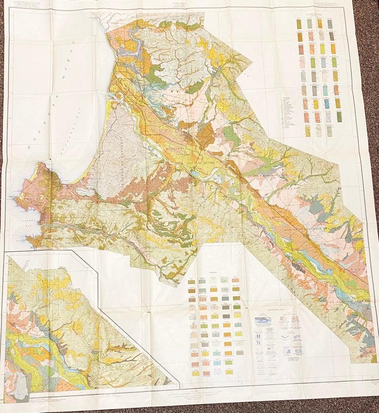
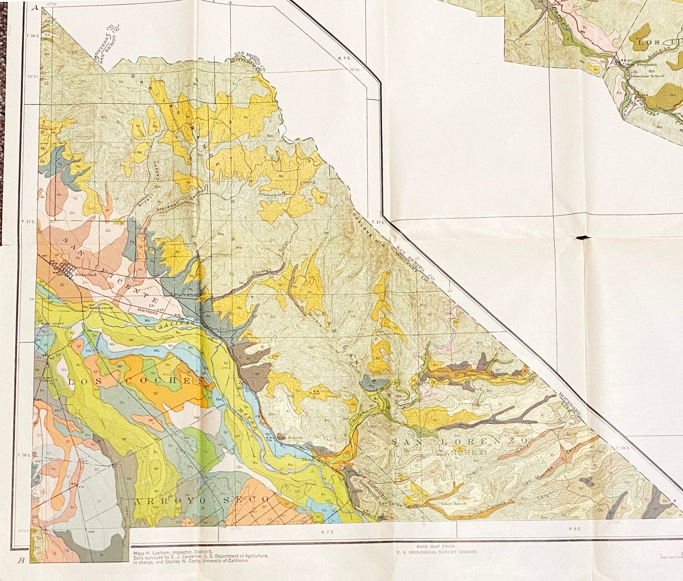
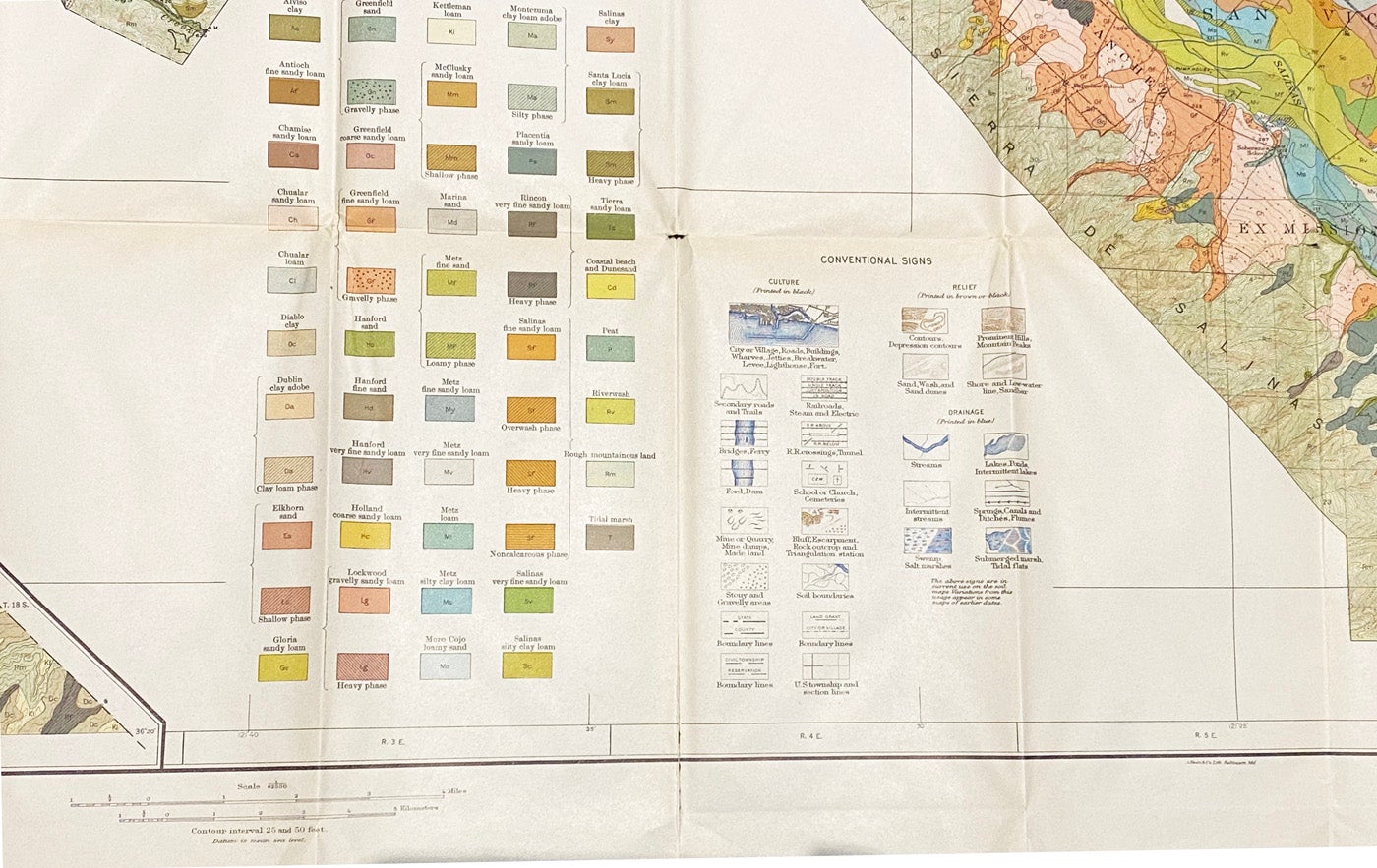
Soil Map: Salinas Area California
United States Department of Agriculture, Bureau of Chemistry and Soils [and] California Agricultural Experiment Station. 1925. Large folding color map (42 x 38"). Base map from U.S. Geological Survey sheets. 2" split at lower edge foldline; 2 small splits at interior folds; short tape on verso; else a fine copy. Item #14175
Centered on the Salinas Valley, this colorful map presents a huge amount of information in the Monterey County region. The map contains a legend of tones to delineate soil types, each shown with its own color and pattern. Conventional Signs delineate citys, villages, roads, buildings, wharves, jetties, lighthouses, forts, trails, fords, dams, mines, quarries, railroads, tunnels, schools, churches, cemetaries and much more. The soils were surveyed by E.J. Carpenter and Stanley W. Cosby.
The Salinas Valley is one of the major valleys and most productive agricultural regions in California. It is located west of the San Joaquin Valley and south of San Francisco Bay and the Santa Clara Valley. Agriculture dominates the economy of the valley. Promoters call the Salinas Valley "the Salad Bowl of the World" for the production of lettuce, broccoli, peppers and numerous other crops. The climate and long growing season are also ideal for the flower industry and grape vineyards planted by world-famous vintners. It is also known for being the setting of the novels East of Eden, Tortilla Flat, Of Mice and Men, The Chrysanthemums, and Johnny Bear by John Steinbeck.
Price: $350.00