
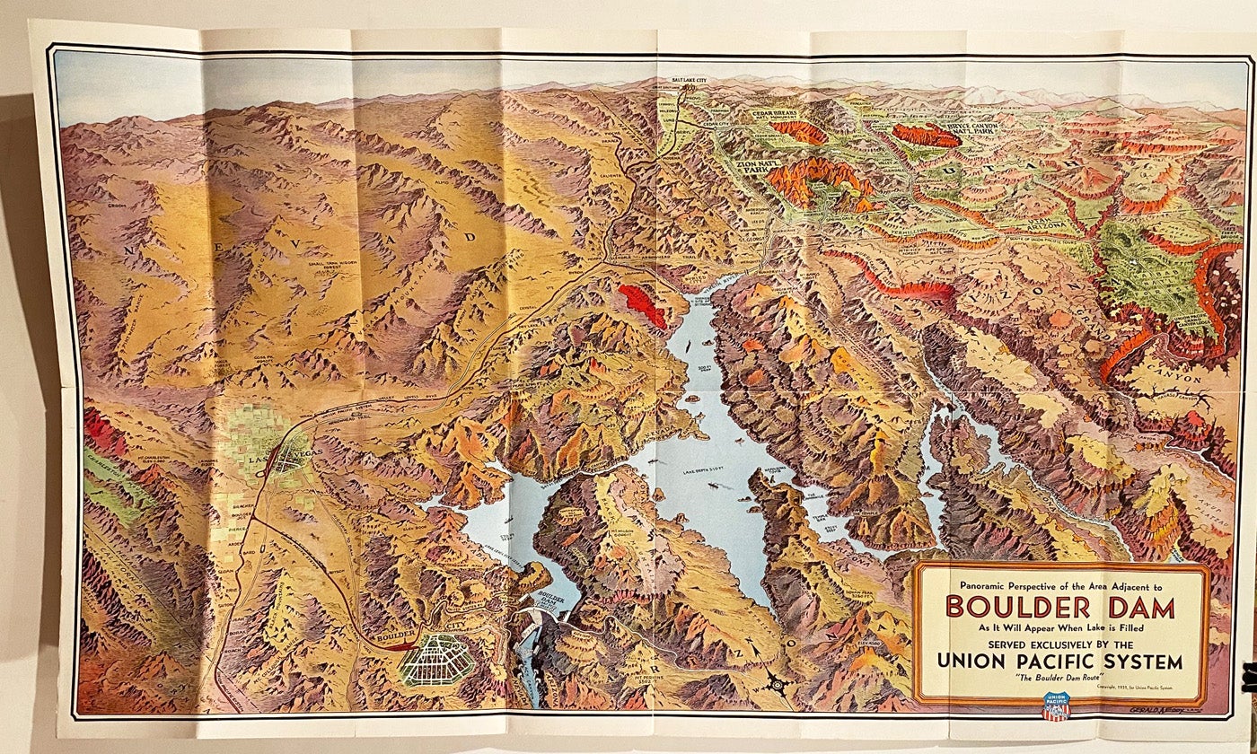
Panoramic Perspective Map of Boulder Dam and Adjacent Area as it Will Appear When Lake is Filled
[Omaha, NE]: Union Pacific System, 1935. Color birds-eye perspective map drawn by Gerald A. Eddy (46 x 78 cm), folded into self-wrappers. On verso: text, illustrations, and "Map of the Union Pacific System and through car lines." Printed by Poole Bros. in Chicago. A near fine copy (3 short splits at edges, not affecting the map), Item #18784
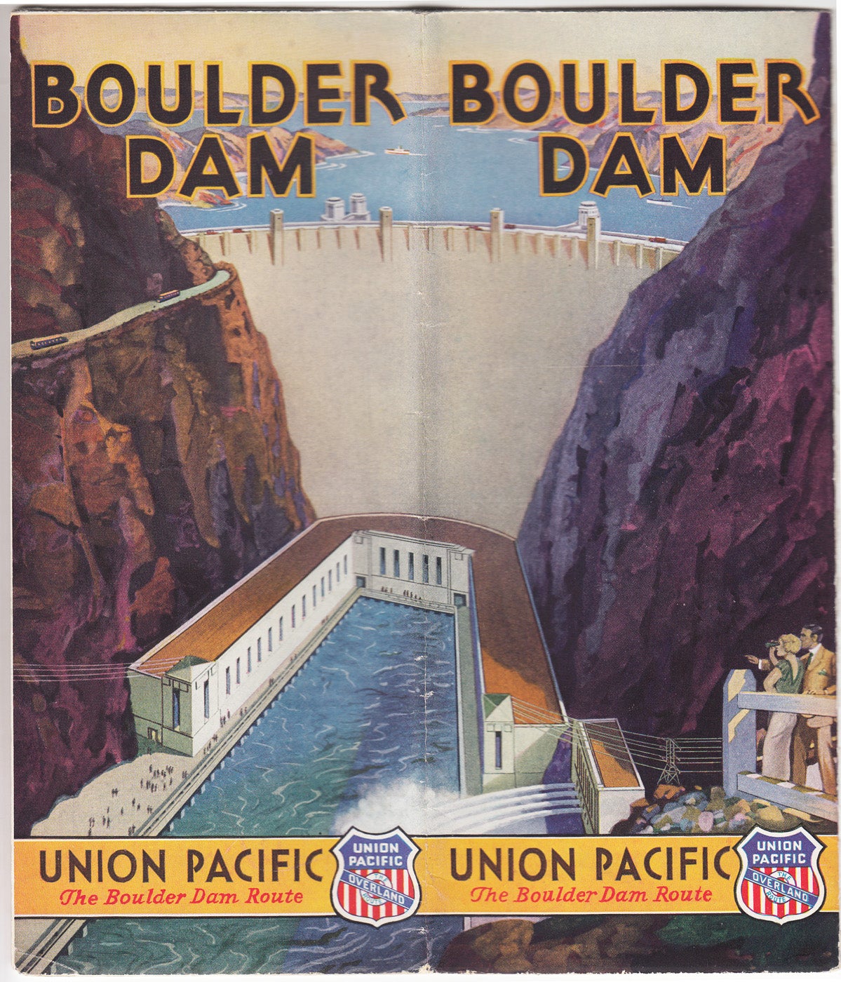
A colorful tourist promotional map showing the locations of important nationals parks, monument, lodges and cities including Bryce, Zion, Cedar Breaks, Grand Canyon, Valley of Fire, Las Vegas, Boulder City and more. The reverse side of the map includes Facts Concerning Boulder Dam, How to Visit, and information about Boulder City and Las Vegas.
Price: $150.00